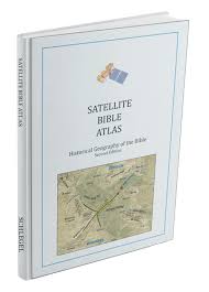
This Bible Atlas is extraordinary. I’m a Bible Atlas nut, and own most all Bible atlases in print today. Somehow, I had missed this one until now. I’m so impressed with this volume, that if I were forced to have only two Bible atlases in my library I would pick The Carta Bible Atlas for its scholarship and coverage of many Bible events, and this volume by William Schlegel for its conservative viewpoint and typography as well is its coverage.
I’ve seen some other satellite maps of Bible lands, but they are much inferior to this volume. The author here has a much better grasp of what you really need in a Bible Atlas map. The satellite imagery allows you to see at a glance the typography that plays such a part in many Bible episodes. A majority of the maps take up a full-page, which makes them the perfect size. Color, information overlays like direction of movement, and good labeling make these maps ideal.
The text follows the Bible in chronological order and gives all kinds of wonderful information. There is information about the Bible story itself in some cases, plus other topographical information, as well as some discussion of where the Bible site is located and can be found today. Because the author “takes a conservative view of biblical chronology, accepting chronological numbers given in the Bible at face value”, I’d label this volume refreshing.
In addition to the maps and text, several photographs are interspersed throughout the text. Most of the photos are by Todd Bolen, who is one of the best photographers of Bible sites today. There are so many fine maps in this book, and several of them stand out. I especially enjoyed the maps of Jerusalem overlaid upon a topographical map. Don’t miss the regional map on page 148, nor the index to major sites that will be really helpful for more in-depth study.
This Atlas succeeds on all levels! It will make for pleasurable hours and effective study. I give it the highest recommendation!
I received this book free from the publisher. I was not required to write a positive review. The opinions I have expressed are my own. I am disclosing this in accordance with the Federal Trade Commission’s 16 CFR, Part 255.

Reblogged this on Talmidimblogging.
Jimmy,
Glad you can recommend the Satellite Bible Atlas (I am the author). Allow me to note that the atlas also comes with jpg downloads of all the maps in the book, plus over 70 aerial photographs of major biblical sites.
There are also teaching videos that explain the major geographical features of the regional maps in the first chapter of the book. https://www.youtube.com/user/SatelliteBibleAtlas
There are some other free supplementary materials available on the SBA webpage:
https://www.bibleplaces.com/satellite-bible-atlas-schlegel/
Thanks for the information. You have a great atlas here! God bless.